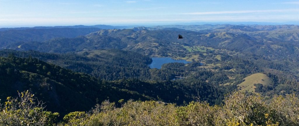
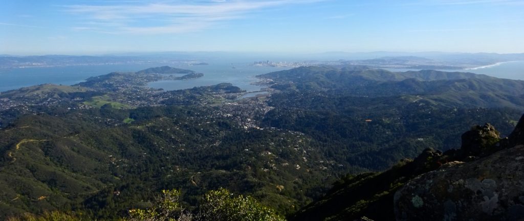
Bask in views of San Francisco, three bays, and beyond atop Mount Tam.
On a clear day at East Peak on Mount Tamalpais you’ll be treated to awe-inspiring views of San Francisco, three bays, and beyond. Several routes will deliver you to the peak, at elevation 2,571 feet the highest point in Mount Tamalpais State Park.
Note: At 5 miles round-trip this hike is relatively short. That said, it’s tricky in a couple of spots, though not terribly so if you’re in reasonably good shape.

Up the Fire Road
Park in the lot across the Panoramic Highway from the Mountain Home Inn. If the lot is full, look for spaces to the south along the highway. A few hundred feet north of the lot, take the right fork as Panoramic curves westward, and then immediately take Hogback Fire Road, the left of the three roads splitting off just beyond this point. (If you’re on the correct route, the county fire station will be on your right a few hundred feet north.) Follow Hogback to Old Railroad Grade to Fern Creek Trail, which leads to the East Peak Visitor Center parking lot.
From the parking lot, follow signs a half mile to East Peak and bask in its perfect views. On a clear day you can see all the way to Mount Diablo in the East Bay.
To return, either backtrack or head west past the end of the parking lot to Old Railroad Grade Road. Follow the road south to Nora Trail and the Matt Davis Trail east back to Hogback Fire Road. Continue south to the Mountain Home Inn.

East Peak Details
Difficulty level: Moderate to challenging.
Why locals love it: Good workout; perfect views; top-of-the-world feeling.
Cut to the chase: Drive west on Panoramic Highway, north on Pantoll Road and northeast on East Ridgecrest Boulevard. From the East Peak parking lot it’s only half a mile to the peak.
Reward yourself: Soak in more mountain views enjoying a drink or a light meal on the deck at the Mountain Home Inn.

Getting Here
Panoramic Highway is north off Highway 1 (also signed as Shoreline Highway) in Mill Valley. From the north or south, take U.S. 101’s Exit 445B (Stinson Beach/Highway 1) and follow Highway 1. After about 2.5 miles turn right on Panoramic Highway and continue for another 2.5 miles.
Info
Parking lot across from Mountain Home Inn
818 Panoramic Hwy., Mill Valley CA 94941
More Hikes Locals Love
Abbotts Lagoon
Battery Mendell to Battery Townsley
Coastal Trail to Bass Lake and Alamere Falls
Coastal, Wolf Ridge, Miwok Trails Loop
Dipsea Trail
Mount Tamalpais Muir Woods Loop
Olompali State Park
Rodeo Lagoon to Point Bonita Lighthouse
Rodeo Lagoon Trail Loop
Roy’s Redwoods Open Space Preserve
Steep Ravine to Matt Davis Loop
Tennessee Valley
Tule Elk Preserve

Pingback: STORY INDEX BY REGION – Daniel Mangin