Remnants of hot and cold wars add a historical component to this invigorating Marin Headlands hike with city, ocean, and mountain views.
Coastal Trail
Start at Rodeo Beach on the hikers’ portion of the Coastal Trail, which meanders closer to the coast than the (at this point) paved section for bikers. Even on a sunny day, the best time to walk here, you’ll hear the clanging of offshore buoys.
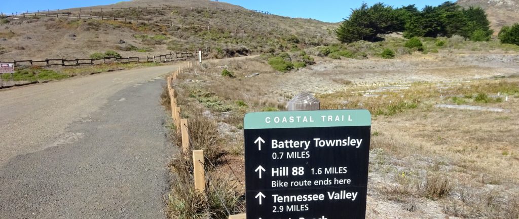
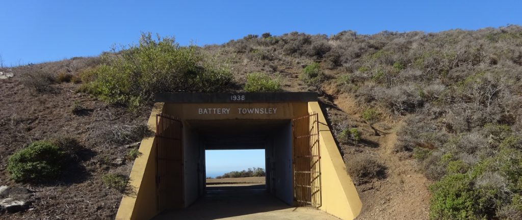
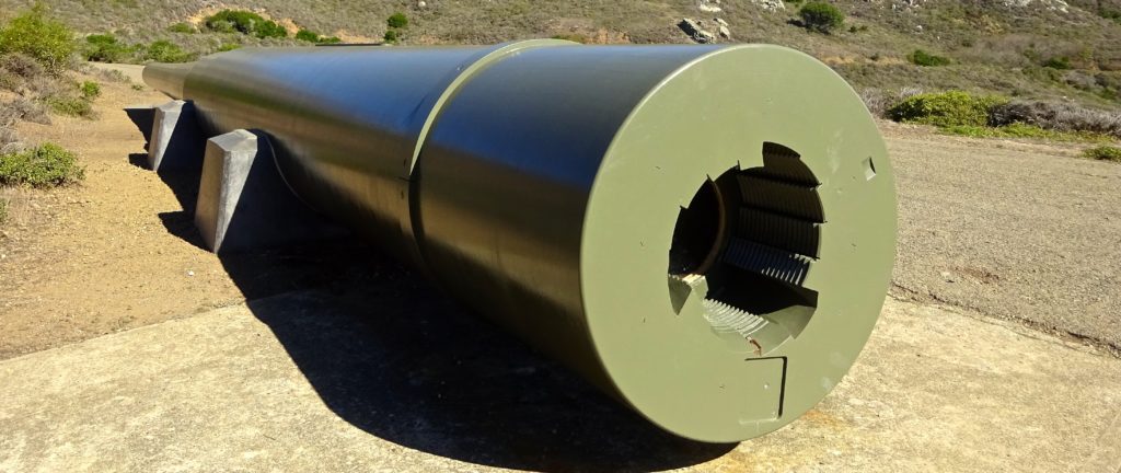
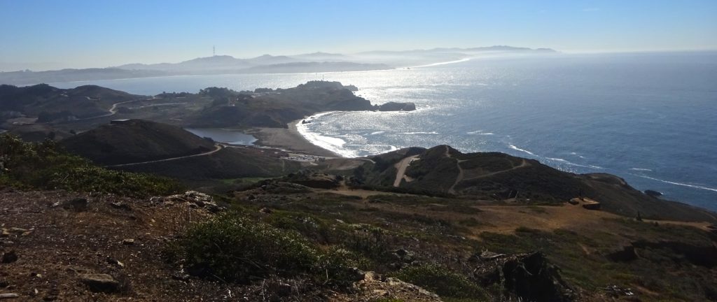
A 68-foot-long, 120-ton gun barrel marks one of the entrances to Battery Townsley; the weapon is similar to the ones that guarded the West Coast during World War II. The views of San Francisco, terrific from here, keep getting better as you continue north and east up sometimes steep terrain to desolate Hill 88, once the tracking and control center for the Nike antiballistic missile complex that operated at the Headlands during the Cold War.
Wolf Ridge and Miwok Trails
Along the way to the desolate control center, which is just off the Coastal Trail, you can peer into the Tennessee Valley. Continue east to the Wolf Ridge Trail, following it to the Miwok Trail, which after winding south a mile rejoins the Coastal Trail near the Marin Headlands Visitor Center. From here follow the Rodeo Lagoon Trail back to Rodeo Beach.
Coastal, Wolf Ridge, Miwok Trails Loop Details
Difficulty level: Moderate.
Why locals love it: Terrific views; interesting slices of natural and military history.
Cut to the chase: Walk 1.5 miles round-trip from Rodeo Beach to Battery Townsley.
Reward yourself: Head into Sausalito for the “ethnic confusions” of Avatar’s, an Indian-Mexican (and a few other things) restaurant or coffee and a light meal at Firehouse Coffee & Tea.
Getting Here
If heading north from San Francisco: Just past the Golden Gate Bridge take the Alexander Avenue exit and immediately turn left. Follow the Marin Headlands Tunnel Route, turning right at the T intersection after passing under U.S. 101. Once through the tunnel, continue west on Bunker Road, then Mitchell Road. Follow signs to Rodeo Beach.
If heading south on U.S. 101 from anywhere in Marin: Take the Alexander Avenue exit and immediately turn right. Follow Marin Headlands Tunnel Route. Once through the tunnel, continue west on Bunker Road and then Mitchell Road. Follow the Rodeo Beach sign.
If heading south from downtown Sausalito: Drive south on Bridgeway. Turn right on Richardson Street, left on Second Street, and left on South Street, which becomes Alexander Avenue. Follow the Marin Headlands Tunnel Route. Continue west through the tunnel on Bunker Road and then Mitchell Road. Follow Rodeo Beach signs.
Info
Trailhead (Coastal Trail)
Marin Headlands, Mitchell Rd., Rodeo Beach
More Hikes Locals Love
Abbotts Lagoon
Battery Mendell to Battery Townsley
Coastal Trail to Bass Lake and Alamere Falls
Dipsea Trail
East Peak Mount Tamalpais
Mount Tamalpais Muir Woods Loop
Olompali State Park
Rodeo Lagoon to Point Bonita Lighthouse
Rodeo Lagoon Trail Loop
Roy’s Redwoods Open Space Preserve
Steep Ravine to Matt Davis Loop
Tennessee Valley
Tule Elk Preserve
This story first appeared online in 2017; it was fact-checked and updated in 2020.
Pingback: STORY INDEX BY REGION – Daniel Mangin