Great San Francisco day trip is a worthy destination in its own right.
California’s Coast Range forms the spine of Marin County, a peninsula of striking and varied beauty. A hiker’s paradise, the county lies south of the Sonoma County wine region and north of San Francisco. With its craggy hills, windswept beaches and mellow bay and seaside towns, Marin makes a great San Francisco day trip. It’s a worthy destination in its own right, too.
Muir Woods National Monument and its redwoods, almost-too-cute Sausalito, and ruggedly majestic Point Reyes National Seashore are the marquee attractions. The divine Marin Headlands, which start at the northern end of the Golden Gate Bridge, are another draw. The headlands stand tall off highway U.S. 101 in southern Marin. Mill Valley, also in the south, is the gateway to Muir Woods and trail-laced Mount Tamalpais State Park. Stinson Beach, Bolinas and other towns along Highway 1 punctuate the coastline north from the headlands to Point Reyes National Seashore. Olema, Point Reyes Station and Inverness serve as the seashore’s gateways.
Here are a few Marin County highlights:
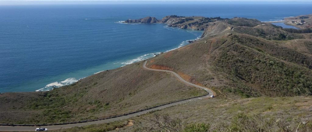
Marin Headlands
A glorious perch at the northern end of the Golden Gate Bridge, the craggy Marin Headlands supply photo ops aplenty. You can prolong the pleasure with a scenic drive, an easy or moderate hike, or sessions watching birds and other wildlife. Historic civilian and military structures also await investigation, and equally grand Pacific Ocean views unfold from lofty cliffs and sea-level beaches. Breathtaking even on a foggy or windswept rainy day, the headlands are best visited when the sun is shining bright and visibility is high.

Muir Woods National Monument
Muir Woods, a forest of old-growth coast redwoods, is too popular for its own good. Just 10 miles from the Golden Gate Bridge’s northern vista point, it attracts hordes, especially on summer weekends. Despite the crowds, the park lives up to the endorsement of its namesake, the famed naturalist John Muir: “This is the best-tree lover’s monument that could possibly be found in all the forests of the world.” The busiest days, though, require you to venture deeper into Muir Woods to sense what its namesake meant. To avoid the hubbub, locals in the know arrive via the “back door” on a hike.
Point Reyes National Seashore
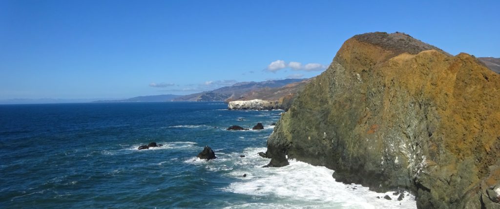
Sir Francis Drake Boulevard leads west from U.S. 101 and Marin’s densely populated eastern portion to Point Reyes National Seashore. This windswept peninsula occupies the county’s northwestern corner. The beaches and hiking trails here are glorious and largely secluded, yet first-class dining awaits in the small towns bordering the park. Vestiges of the area’s history as dairy country remain, and several artisan cheese and yogurt makers have helped revive the local industry. Hikes in the park include ones to Abbotts Lagoon and through the Tule Elk Preserve.

Sausalito
Visitors to the San Francisco Bay Area often slot in time for a laid-back afternoon in Sausalito. Some add the excitement of arriving by ferry or bicycling across the Golden Gate Bridge. On a sunny day, Sausalito is one of the bay region’s prettiest spots. Its seawall promenade and restaurants on piers provide plenty of places to bask in the magnificent views of two bays, several islands, and the San Francisco skyline. Should the natural splendor entice you to stay more than a day, there are several good waterfront lodgings.
Great Marin County Hikes
Abbotts Lagoon
Battery Mendell to Battery Townsley
Coastal Trail to Bass Lake and Alamere Falls
Coastal, Wolf Ridge, Miwok Trails Loop
Dipsea Trail
East Peak Mount Tamalpais
Mount Tamalpais Muir Woods Loop
Olompali State Park
Rodeo Lagoon to Point Bonita Lighthouse
Rodeo Lagoon Trail Loop
Roy’s Redwoods Open Space Preserve
Steep Ravine to Matt Davis Loop
Tennessee Valley
Tule Elk Preserve
When to Visit Marin County
Marin County is a year-round destination. As might be expected of such an outdoors-oriented place, from late spring to mid-fall is high season in Marin County, though even in summer it’s easy to participate in most activities here. The exceptions include Muir Woods National Monument; it’s best to come here early or late in the day, keeping in mind that as at other times parking or shuttle reservations are required. On sunny summer weekends, parking can be difficult to find in Marin’s small beach towns, especially Stinson Beach and Bolinas. You can see the county’s highlights in two or three days.
Climate
Marin County has a mild climate. During the day, the inland temperatures are usually between 60°F and 70°F in spring and late fall and 80°F and 90°F during the summer and early fall, with a few days as high as 100°F inland. From spring into fall, temperatures on the coast are often from 15 to 25 degrees lower than those inland, and southern Marin is often cooler than the northern county. The coast can turn foggy and windy at any time, so it’s wise to carry a sweater or jacket even in summer. On most days in summer, the fog burns off by noon or so and doesn’t roll back in until the early evening if at all. In nondrought years, the rainy season starts in late October or early November, with the heaviest precipitation often from December through February. From May to October it rains very little, if at all.
Events, Festivals
Spring
Marin Open Studios
See local artists where they create their works. First two weekends in May.
Summer
Marin County Fair
Excellent concerts by rock and other acts are part of this celebration of county creativity. Early summer.
Fall
Mill Valley Fall Arts Festival
The festival presents fine art and live music under the redwoods of Old Mill Park downtown. Mid-September.
Mill Valley Film Festival
This influential film festival presents many American indie and other premieres. Early October.
What to Wear
Casual attire is the norm in Marin, though it’s a good idea to upgrade to dressy casual when dining at nicer establishments. Sausalito, the Marin Headlands, and the western coastline can be foggy and windy at any time, so it’s wise to carry a sweater or light jacket even in summer. Jackets and sweaters are rarely needed inland from late spring to mid-fall, and even on most winter days you won’t feel the need to bundle up too much. If you’ll be tackling the moderate or difficult hiking trails, where the footing can be tricky, consider packing hiking boots.
Getting to Marin
Marin County is within easy reach of the San Francisco Bay Area’s two major airports. For car drivers, U.S. 101 connects Marin with Sonoma County to the north and (via the Golden Gate Bridge) San Francisco to the south. The Richmond–San Rafael Bridge connects Marin with East Bay towns such as Berkeley and Oakland. Public-transit options include buses, ferries, and SMART passenger rail service between Sonoma County and central Marin.
By Air
San Francisco International Airport (SFO), served by many major airlines, is about 22 miles south of Marin County off U.S. 101. In normal traffic, including on surface streets in San Francisco, it takes about 45 minutes to drive from the airport to the middle of the county.
Oakland International Airport (OAK), also served by many major airlines, is about 35 miles southeast of the middle of Marin County via interstate highways 880 and 580 and the Richmond–San Rafael Bridge. The drive takes about 45 or 50 minutes in normal traffic.
Transfers: The dependable Marin Airporter bus, which operates from SFO to Marin between 5 AM and midnight, is convenient and inexpensive. Buses to SFO operate between 3:50 AM and 10:50 PM. No direct public transportation operates from Oakland’s airport to Marin. There are several shuttle options, though reliability is an issue with some of the companies.
Uber, Lyft, and other ride-sharing services operate out of both airports. For a ride in a town car, contact Marin Car Service.
By Car
U.S. 101 is the main auto route into Marin County, north over the Golden Gate Bridge from San Francisco and south from Petaluma in Sonoma County. Other routes into Marin include Highway 1 south from northern Sonoma County, Highway 37 west from southern Sonoma County, and Interstate 580 west (over the Richmond–San Rafael Bridge) across the San Francisco Bay from the East Bay town of Richmond.
By Bus
Marin County’s main bus company, Golden Gate Transit, serves passengers along the U.S. 101 corridor, traveling as far north as Petaluma and Santa Rosa, in Sonoma County, and south into San Francisco. The San Francisco service includes many commuter routes south into the city in the morning and north into Marin and Sonoma counties in the afternoon.
By Ferry
Golden Gate Ferry commuter vessels connect San Francisco and Sausalito and Larkspur, the latter in central Marin east of U.S. 101. The Blue & Gold Ferry transports passengers from San Francisco to Sausalito and Tiburon.
By Train
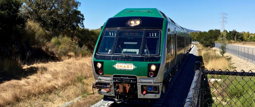
SMART (Sonoma–Marin Area Rail Transit) operates passenger rail service between Santa Rosa, Sonoma County’s largest city, and downtown San Rafael, in central Marin, with a final stop at Larkspur Ferry (for boats to San Francisco).
511 SF Bay provides comprehensive information about traffic and public transit throughout the Bay Area. On the organization’s website you can get real-time traffic reports.
Getting Around Marin
By Car
Driving a car is by far the most efficient way to explore Marin County. U.S. 101 is the main north–south highway through the county. Sausalito, Tiburon, Mill Valley, Corte Madera, Greenbrae, San Rafael, and Novato all straddle the highway. Highway 1 branches west from U.S. 101 to Stinson Beach and continues north to Point Reyes National Seashore. Sir Francis Drake Boulevard branches west from U.S. 101 in central Marin County, traveling through San Rafael, San Anselmo, Fairfax, and Lagunitas on its way to Olema, Point Reyes Station, and Inverness, the last three within the orbit of Point Reyes National Seashore.
On weekdays, commuter traffic from Sonoma County into northern Marin via U.S. 101 is extremely heavy from about 7 AM until 9:30 AM. Traffic often backs up as early as 3 PM in southern Marin and in northern Novato and stays heavy until after 6 PM. Locals try to time trips within the county and into San Francisco around this congestion. Because there is only one main north–south artery through the county, if there is an accident or other disturbance on the freeway, traffic often comes to a standstill.
By Bus
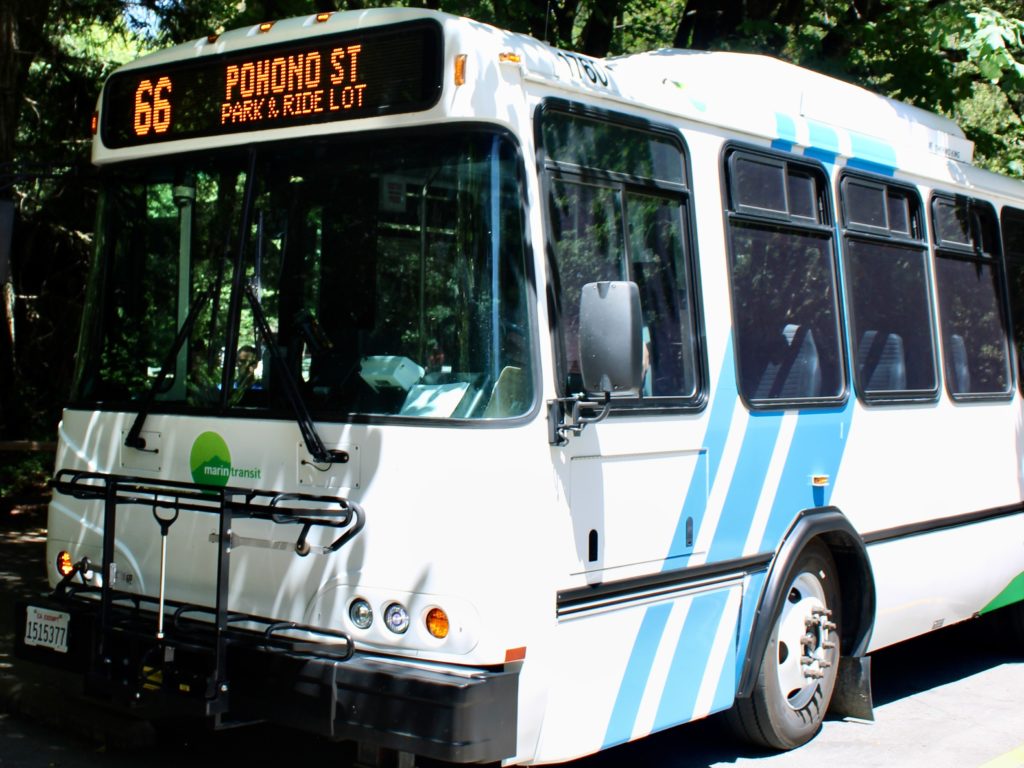
Though it’s not always practical time wise, you can get around much of Marin County by bus. The main bus company, Golden Gate Transit, serves the U.S. 101 corridor and other high-profile routes, some under contract with Marin Transit, which oversees several outlying routes of interest to visitors. These include Route 66, aka the Muir Woods Shuttle. (Visit the Muir Woods Reservations website for more Muir Woods National Monument transportation information.) Marin Transit’s West Marin Stagecoach Route 61 connects Marin City, near U.S. 101 and Sausalito, with Stinson Beach, Bolinas, and the Pantoll Ranger Station in Mount Tamalpais State Park. Route 68 connects the San Rafael Transit Center with Point Reyes and other West Marin locations.
The San Rafael Transit Center, just off U.S. 101 between 2nd and 3rd streets and Tamalpais Avenue and Hetherton Street in central San Rafael, is Marin County’s transportation hub. Golden Gate Transit, Marin Transit, West Marin Stagecoach, Sonoma County Transit, and the Marin Airporter buses all stop here. A block from the transit center is the Downtown San Rafael Station of the SMART passenger rail line between Sonoma County and central Marin. The station is the line’s southern terminus; there’s a spur to the Larkspur Ferry.
Marin County History
A Brief History of Sausalito
Marin County’s Bounty
This story first appeared online in 2017; it was fact-checked and updated in 2022.

Pingback: STORY INDEX BY REGION – Daniel Mangin